The Central Meteorological Observatory issued a yellow typhoon warning at 10: 00 on July 16th.
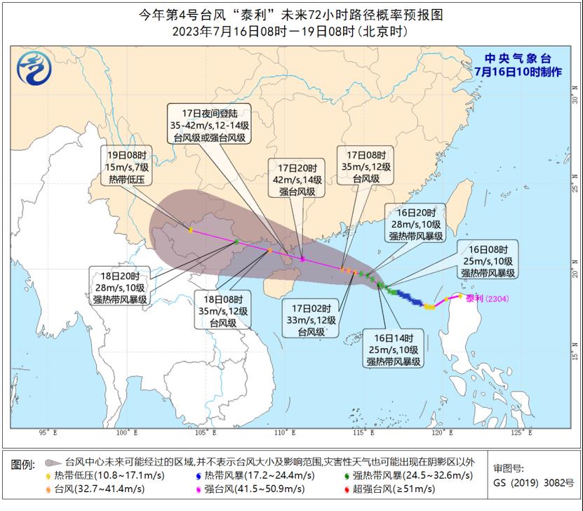
CCTV News:According to the website of the Central Meteorological Observatory, the center of the No.4 typhoon "Taili" (a strong tropical storm) this year is located at 9: 00 am today (16th) in the northeast of the South China Sea, about 660 kilometers south-east of Zhanjiang City, Guangdong Province, China, which is 18.9 degrees north latitude and 116.2 degrees east longitude. The maximum wind force near the center is 10 (25m/s), and the lowest pressure at the center is 985 hectopascals.
It is estimated that "Taili" will move northwest to north-north at a speed of about 15 kilometers per hour, and its intensity will gradually increase. It will land on the coast from Taishan in Guangdong to Wenchang in Hainan on the night of the 17th (typhoon level or strong typhoon level, 35-42m/s, 12-14), enter the Beibu Gulf on the 18th, and then move towards the northern coast of Vietnam.
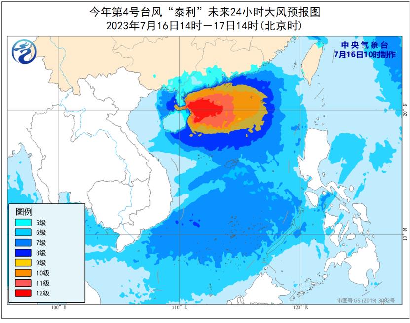
Gale forecast: From 14: 00 on July 16th to 14: 00 on July 17th, there will be 6-7 winds in most parts of the South China Sea, coastal areas of Guangdong, eastern Beibu Gulf, Xisha, Zhongsha, Nansha and Huangyan Island, 8-10 winds in some sea areas in the central and northern South China Sea and near Dongsha, 11-12 winds in the sea areas and islands where the typhoon center passes, and 13-14 gusts.
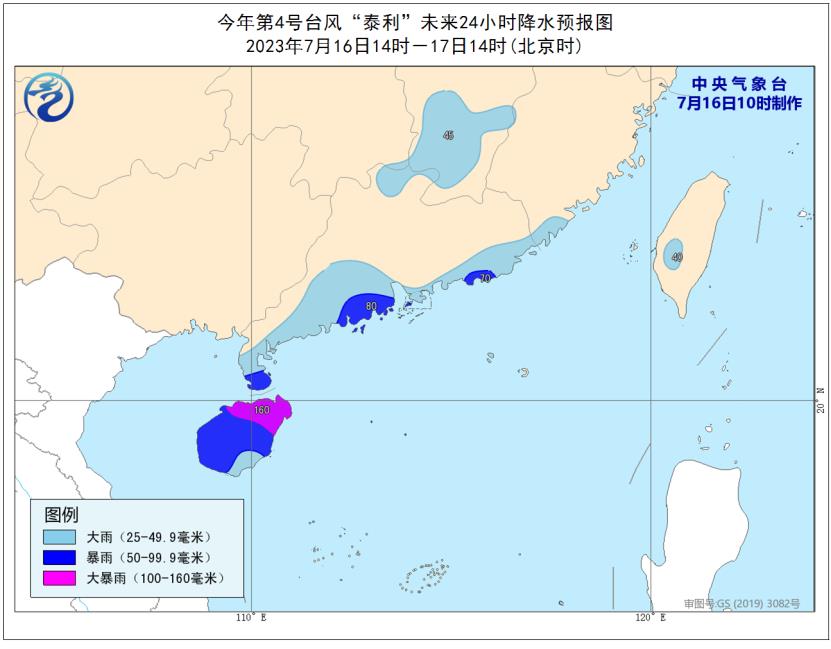
Precipitation forecast: From 14: 00 on July 16th to 14: 00 on July 17th, there will be moderate to heavy rain in parts of southern and northern Guangdong, Hainan Island, southeastern Fujian, central and southern Jiangxi and southern Taiwan Province Island, among which there will be heavy rain or heavy rain (100-160mm) in Hainan Island, southern Leizhou Peninsula and southern coastal areas of Guangdong.